Photogrammetry has emerged as a powerful technique for creating accurate and detailed representations of real-world objects. It’s a technique used to create three-dimensional (3D) models or measurements of real-world objects and environments using a collection of photographs. By analyzing the geometric relationships between multiple images of an object or a scene, photogrammetry software can extract precise measurements, dimensions, and textures to reconstruct an accurate representation of the subject in 3D. This guide examined the best drone photogrammetry software as well as some of the best free and open-source photogrammetry software available.
Understanding Photogrammetry
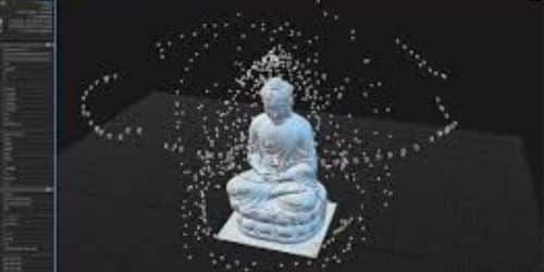
Photogrammetry provides a powerful and cost-effective means to capture and digitize physical reality, offering numerous opportunities for innovation and creativity across a wide range of industries and applications. The process typically involves capturing a series of overlapping photographs from different angles around the object or scene of interest. These photographs can be taken using specialized cameras or even consumer-grade cameras, depending on the desired level of accuracy and detail. The photographs should ideally cover the subject from all sides, capturing its surface from different viewpoints. It transforms ordinary photographs into captivating 3D models and photogrammetry software serves as an indispensable tool in achieving this. By utilizing photographs captured from different angles, photogrammetry software can reconstruct three-dimensional models with impressive precision and realism.
Once you obtain the photographs photogrammetry software utilizes various algorithms and techniques to analyze the images, identify common points or features, and also calculate their positions in 3D space. By triangulating the positions of these points across multiple images, the software can reconstruct the 3D geometry of the object or scene, creating a point cloud, which is a dense collection of 3D points representing the surface.
From the point cloud, the photogrammetry software can further process the data to generate a mesh, which is a connected network of polygons that forms the surface of the 3D model. The mesh can then be textured using the original photographs or by applying color information from the images to create a visually realistic representation.
Photogrammetry finds applications in various industries and fields, including architecture, engineering, construction, archaeology, cultural heritage preservation, virtual reality, video game development, and film production. It allows professionals and enthusiasts to capture and recreate real-world objects and environments in a digital format, enabling measurements, visualizations, simulations, and virtual experiences that would otherwise be challenging or costly to achieve.
What Is Photogrammetry Software?
Photogrammetry software refers to a category of computer programs that are used to extract three-dimensional (3D) models or measurements from two-dimensional (2D) images. These software applications utilize the principles of photogrammetry, which is the science of making measurements from photographs.
What Does Photogrammetry Software Do?
Photogrammetry software analyzes multiple 2D images to create 3D models or measurements of objects or scenes. It aligns images, generates a point cloud representing 3D coordinates, creates a mesh to define surface topology, applies textures for realistic representation, and produces complete 3D models. The software enables measurements, analysis, orthophoto generation, and georeferencing for integration with geographic data. It is used in industries such as architecture, cultural preservation, virtual reality, gaming, surveying, and more.
Best Photogrammetry Software
If you are on the lookout for the best photogrammetry software, then look no further, this is for you; check out the list below;
#1. Agisoft Metashape (formerly Photoscan)
Agisoft Metashape (formerly known as Agisoft PhotoScan) is a popular photogrammetry software developed by Agisoft LLC. It is designed to process digital images and generate high-quality 3D models, point clouds, and orthomosaics using the principles of photogrammetry. The key features of Agisoft Metashape photogrammetry include image processing, dense point clouds, and mesh generation, texture and UV mapping, digital elevation model, and so on. Agisoft Metashape is used in various industries, including architecture, cultural heritage preservation, geospatial mapping, agriculture, mining, and visual effects. It provides a comprehensive set of tools for processing and analyzing image data to create accurate and detailed 3D models and maps.
#2. Pix4D
Pix4D is a leading software company that specializes in photogrammetry and drone mapping solutions. The company’s primary product, also called Pix4D, offers powerful tools for transforming images captured by drones, aircraft, or other imaging devices into accurate and detailed 2D maps and 3D models. Additionally, professionals in fields like surveying, construction, agriculture, mining, and environmental monitoring use Pix4D extensively. Its powerful capabilities, ease of use, and continuous development have made it a trusted solution for creating accurate maps, 3D models, and actionable insights from aerial imagery.
The following are the key features of Pix4D;
- Image Processing
- 3D Reconstruction
- Mapping and Surveying
- Point Cloud Editing and Analysis
- Thermal Mapping
- Cloud-Based Collaboration
- Integration with Other Tools
#3. RealityCapture
RealityCapture has gained popularity among professionals in the photogrammetry field due to its robust algorithms, speed, and accuracy. It provides a comprehensive suite of tools for generating high-quality 3D models and maps, enabling users to create realistic and detailed representations of real-world objects and environments.
RealityCapture stands out as a powerful photogrammetry software due to its advanced capabilities and high-quality results. It utilizes a range of innovative algorithms to handle complex scenes and deliver accurate and detailed 3D reconstructions. The software supports various input formats, including images from professional cameras, drones, or even smartphone cameras. The following are the key features of RealityCapture;
- Image Alignment
- Mesh Generation
- Outputs
- Editing and Optimization
- Automation and Batch Processing
#4. Autodesk ReCap
Autodesk ReCap is a photogrammetry software developed by Autodesk, a leading provider of 3D design, engineering, and entertainment software. ReCap allows you to convert photos or laser scans into accurate 3D models or point clouds, which can be used in various industries such as architecture, construction, manufacturing, and media. Autodesk ReCap is a powerful tool for creating accurate 3D models and point clouds from photos or laser scans. It simplifies the process of capturing and converting real-world data into digital representations, enabling professionals in various fields to visualize, analyze, and work with 3D information effectively.
The key features of Autodesk Recap are below;
- Photogrammetry Processing
- Point Cloud Generation
- 3D Mesh Generation
- Registration and Alignment
- Cleanup and Editing
- Collaboration and Integration
#5. 3DF Zephyr
3DF Zephyr is a robust photogrammetry software that has gained recognition for its powerful capabilities in the field of 3D modeling and reconstruction. Developed by 3Dflow, a leading company in the photogrammetry industry, 3DF Zephyr offers a comprehensive suite of tools designed to generate accurate and high-quality 3D models from a collection of 2D images.
One of the notable features of 3DF Zephyr is its user-friendly interface, which makes it accessible to both professionals and beginners. The software employs a workflow-based approach, guiding users through the various steps required to create a 3D model. From importing images and aligning them to generating a dense point cloud and finally producing a textured mesh, 3DF Zephyr streamlines the entire photogrammetry process.
Is Photogrammetry Easy?
Not entirely easy. But reproducing a perfect 3D digital image is much simpler with this method than with 3D scanning and more accurate than with 3D modeling.
Does Adobe have Photogrammetry Software?
Yes, Adobe has photogrammetry software, known as Adobe Sampler. With its sophisticated photogrammetry features and intuitive design, Adobe Sampler is an invaluable tool. The program offers a cheap way to make comprehensive and realistic 3D models by allowing users to extract them from a collection of photos.
Drone Photogrammetry software
Drone photogrammetry software refers to specialized software tools designed to process aerial images captured by drones and convert them into accurate 3D models, orthomosaic maps, point clouds, or other spatial data representations. These software solutions leverage the principles of photogrammetry, which involves extracting measurements and geometric information from overlapping images. Drone photogrammetry software solutions have varying features, capabilities, and user interfaces.
Features of Drone Photogrammetry Software
The following are some of the features of drone photogrammetry software;
#1. Image Processing
Drone photogrammetry software typically includes advanced algorithms and processing capabilities to analyze and stitch together multiple images taken from different angles and positions. These tools align the images, identify common features, and reconstruct the scene in three dimensions.
#2. 3D Model Generation
One of the primary purposes of drone photogrammetry software is to generate detailed 3D models of the surveyed area. These models represent the terrain, structures, and objects in a virtual environment and can be used for visualization, analysis, and measurements.
#3. Orthomosaic Mapping
Orthomosaic maps are high-resolution, geometrically corrected, and orthorectified images created by stitching together individual images captured by a drone. Photogrammetry software can generate orthomosaics that provide accurate representations of large areas, enabling measurements, planning, and analysis.
#4. Point Clouds
This software often generates point clouds, which are dense collections of 3D points representing the surfaces and features of the surveyed area. Point clouds can be used for detailed analysis, measurements, and further processing in other software applications.
#5. Measurement and Analysis Tools
Drone photogrammetry software may provide tools for taking measurements, performing volumetric calculations, extracting features, and analyzing the data. These features help professionals in various fields such as surveying, construction, agriculture, and archaeology.
#6. Integration with Drones and Flight Planning
Some software solutions offer integration with drones and provide flight planning capabilities. They allow users to define flight paths, automate image capture, and optimize image overlap to ensure accurate and comprehensive data collection.
#7. Export and Collaboration
Drone photogrammetry software often allows users to export the processed data in various formats, such as 3D models, orthomosaics, point clouds, or GIS-compatible files. This enables collaboration, the sharing of data with other software applications, or integration into existing workflows.
Photogrammetry Software Open Source
Photogrammetry open-source software refers to software whose source code is freely available and can be modified and distributed by anyone. These software options provide flexibility and allow users to access and modify their source code according to their requirements. They are also suitable for various projects and offer different features and workflows. The following are some of the best photogrammetry open-source software;
#1. Meshroom
Meshroom is an open-source photogrammetry software developed by AliceVision. It utilizes a node-based workflow and offers a user-friendly interface. This software can generate high-quality 3D models and textured meshes. It is available on GitHub.
#2. Regard3D
Regard3D is an open-source photogrammetry software that supports automatic point cloud and mesh generation. It features multi-view stereo reconstruction and can handle various input formats. Regard3D is compatible with Windows, Mac, and Linux.
#3. COLMAP
COLMAP is an open-source photogrammetry software that provides comprehensive functionalities. It offers both a command-line interface and a graphical user interface (GUI). COLMAP can reconstruct dense point clouds, 3D meshes, and textured models. It is available on GitHub.
#4. OpenMVS
OpenMVS (Multi-View Stereo) is open-source software that focuses on dense point cloud and mesh reconstruction. It takes input from other photogrammetry software, such as VisualSFM or COLMAP, and processes it to generate detailed 3D models. OpenMVS is available on GitHub.
#5. MicMac
MicMac is an open-source photogrammetry suite developed by IGN (the French National Institute of Geographic and Forest Information). It offers a range of features for 3D reconstruction, dense matching, and georeferencing. MicMac is compatible with Windows, Mac, and Linux.
Free Photogrammetry Software
Free software refers to software that can be used, modified, and distributed without any cost. This means you can obtain and use the software without paying a license fee. The following are some popular free photogrammetry software options:
#1. VisualSFM
VisualSFM is a popular free photogrammetry software that supports both automatic and manual feature tracking. It utilizes a sparse reconstruction technique and can handle large-scale 3D reconstruction projects. VisualSFM is compatible with Windows, Mac, and Linux.
#2. Meshroom
Meshroom is an open-source and free photogrammetry software free developed by AliceVision. It offers a user-friendly interface and utilizes a node-based workflow. Meshroom can generate high-quality 3D models and textured meshes.
#3. Regard3D
Regard3D is a free and open-source photogrammetry software that supports automatic point cloud and mesh generation. It has features like multi-view stereo reconstruction and can handle various input formats. Regard3D is available for Windows, Mac, and Linux.
#4. COLMAP
COLMAP is a free and open-source software that provides extensive photogrammetry functionalities. It offers a command-line interface as well as a graphical user interface (GUI). COLMAP can reconstruct dense point clouds, 3D meshes, and textured models.
#5. OpenMVS
OpenMVS (Multi-View Stereo) is an open-source software that focuses on dense point cloud and mesh reconstruction. It takes the output from other photogrammetry software, such as VisualSFM or COLMAP, and processes it to generate a dense and detailed 3D model.
What is the Best Software for Photogrammetry?
The following are the best software for photogrammetry;
- MicMac
- AliceVision
- PIX4Dmapper
- Agisoft Metashape
- RealityCapture
Is Photogrammetry Better than 3D Scanning?
Photogrammetry brings your 3D models to life like never before. One advantage of photogrammetry is that it makes 3D models look more real because the photos are turned into great materials and backgrounds.
Is Photogrammetry Still Relevant?
Sure, it is. The process of getting accurate measurements from images is known as photogrammetry. It has existed in some form for ages and has influenced our knowledge of things like the earth’s surface. It is now essential in many businesses.
Related Articles
- ENTERTAINMENT COMPANY: 11+ Biggest Entertainment Companies
- STOCK TRADING PLATFORMS: Best Places To Buy Stock 2023
- VOICE ASSISTANTS: Everything To Know About Voice Assistants